home | internet service | web design | business directory | bulletin board | advertise | events calendar | contact | weather | cams

|
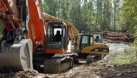
 KRCI construction company out of Wenatchee is using big equipment to move and ‘plant’ logs for their contract to change the Methow River’s flow. KRCI construction company out of Wenatchee is using big equipment to move and ‘plant’ logs for their contract to change the Methow River’s flow.
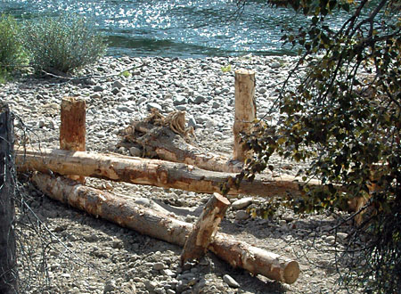
Woody Water The side channel, island and floodplain west of Whitefish Island near Witte Road on the Methow River between Twisp and Winthrop are showing logs and big equipment as contractors work to improve fish habitat. Some logs are planted, fence-post-style, into the Methow’s banks to hold others, lying horizontally. They will change the water’s flow to improve the river for Methow spring Chinook salmon and steelhead, which are listed under the Endangered Species Act. The fish spend their first year in local rivers and streams, according to the Methow Salmon Recovery Foundation’s website. “The quality of the available habitat determines how well the fish grow, gain strength, and become more fit for their journey to the Pacific.”  Some logs are placed upright to pin the horizontal logs that will alter the river currents. Some logs are placed upright to pin the horizontal logs that will alter the river currents.
The Foundation partnered with the Bureau of Reclamation, Bonneville Power Administration and the Upper Columbia Salmon Recovery Board for two habitat projects along the Methow River. The second project, near Twisp, has been started by Palm Construction, but is a multi-year effort. The Whitefish Island project, with contractors KRCI out of Wenatchee, is expected to last until about mid-October. Public tours of the project may be available after that. “We don't have any public tours scheduled at this point. We would generally like to wait until construction is completed for tours, so we don't get in the way of the workers,” said Brian Fisher, Project Manager for the Methow Salmon Recovery Foundation. “Neither of these projects are expected to increase flooding to any existing houses. During the design process, (the Bureau of) Reclamation built a two-dimensional hydraulic model that evaluated how the project will affect flows through the area. This model shows expected water depth, water surface elevations, and water velocity, as well as how these things are expected to change. The modeling shows no significant increased flood risk at anyone's house,” Fisher explained. The trees for the projects came mostly from private lands near Entiat, a site up the Twisp River, a site near the Sanpoil River, Oroville, and a site in western Washington cleared for development or damaged by windstorms, Fisher said. “We're using a mix of primarily Douglas fir and ponderosa pine. There is also some cedar and spruce mixed in.” “This year, we are doing a small portion of the (Washington Department of Fish and Wildlife) floodplain project (near Twisp), including three engineered log jams and removing remnants from the abandoned Methow Valley Irrigation District’s east diversion dam,” Fisher said, adding that this year’s portion of the multi-year project should be done by the end of the month. 9/11/2012
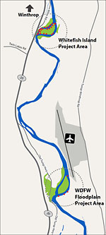
< Map of project locations. Click to enlarge.
Comments
|

